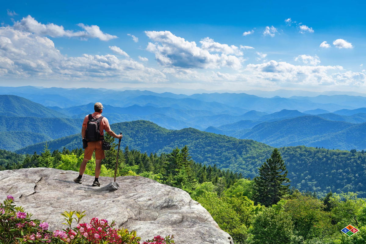
Some of the most beautiful places in the Great Smoky Mountains National Park can’t be reached by roads. With over 800 miles of hiking trails in the park, there are plenty of easy day hikes — but for those looking to explore more remote areas immersed in nature, backpacking in the Smoky Mountains is best.
Before your trek, it’s important to know the specific rules and regulations set by the National Park Service, such as getting Great Smoky Mountains backcountry permits so you can navigate the park.
Before starting your backpacking adventure, following the General Backcountry Regulations of the National Park Service (NPS) in the Great Smoky Mountains National Park (GSMNP) is important. Unless you stay at LeConte Lodge, camping in the park is only allowed at designated backcountry campsites and shelters.
Backpackers should get a Great Smoky Mountains Backcountry permit and make GSMNP backcountry reservations to camp overnight in the park. This is important for your safety and for preserving the park’s natural beauty. Failing to follow these NPS regulations could result in penalties, including fines of up to $5,000 or up to six months in jail.
While the GSMNP does not charge an entrance fee, you will need a paid parking tag if you plan to park for longer than 15 minutes in any of the lots. Daily and weekly parking tags are available on recreation.gov, and if you’re planning to be a park regular, you can purchase annual passes through Smokies Life. If you buy your tag online, print it and display it in your vehicle while visiting the park. Parking tags are also available in the park at the visitor’s center.
General rules for backpacking in the Smoky Mountains:
For the most up-to-date information, please check with the NPS.
| Permit or Reservation Requirement | Purpose | Deadline |
| General Backcountry Permit | To hike in the backcountry of the GSMNP | Anytime up to 30 days in advance |
| Backcountry Camping Reservations | To sleep at a backcountry campground or shelter | Anytime up to 30 days in advance |
| Parking Tag | To park in the park or at the trailheads | Up to six months in advance |
Given that the park covers over 500,000 acres of vast wilderness, choosing the best trails near Gatlinburg for your backpacking adventure can be tough. Using recent recommendations and ratings from the AllTrails app, we’ve compiled a list of eight popular backpacking trails in the Smokies to get you started. Explore old-growth forests, rushing waterfalls, and stunning mountain vistas on the trails below.
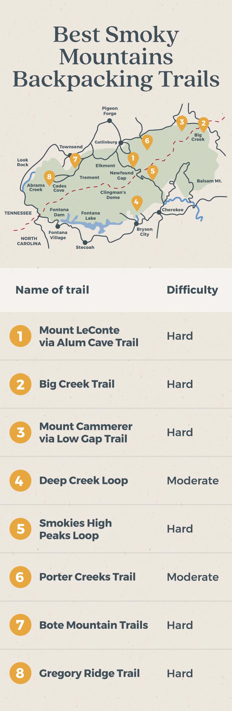
Alum Cave Trail to Mount LeConte is known as one of the best backpacking trails in Great Smoky Mountains National Park — and for a good reason. This scenic 11-mile out-and-back trail gains over 3,000 feet in elevation and passes several famous landmarks, including Arch Rock and Alum Cave Bluffs. It’s a great option for a one- to two-night backpacking loop of the Smoky Mountains. Expect panoramic mountain views, rushing waterfalls, and encounters with other hikers along the way.
Pros
Cons
Big Creek Trail is another popular option near Gatlinburg for backpacking the Smoky Mountains. This 10.4-mile out-and-back trail is open year-round and is known for its refreshing swimming holes at Midnight Hole and Mouse Creek Falls during the summer. The trail is wide, well-marked, and relatively easy, making it a great option for backpackers of varying ability levels.
Pros
Cons
If you’re looking for more of a challenge, this trail gains over 3,100 feet of elevation and offers great views at the top. Backpackers can start by taking the Low Gap Trail, hiking forested switchbacks, and climbing the Crosby Creek Valley before reaching the Appalachian Trail.
From there, you can continue to Mount Cammerer, whose summit is 4,928 feet high and overlooks the Pigeon River Gorge. Open year-round, the trail is well maintained and has plenty of options for adding on miles with connecting trails, making it a great choice for creating a two- to four-day backpacking loop in the Smoky Mountains.
Pros
Cons
This nearly five-mile loop on the North Carolina side of the Smokies is known for its waterfalls, river spots, wildlife sightings, and a tubing site at the trailhead. This relatively easy trail in the Smokies is well-marked and well-maintained, making it a great option for families or younger adventurers.
Backpackers often choose to do Deep Creek as a two- or three-day backpacking loop in the Smoky Mountains. You can take the trail clockwise for a long, slow incline, or go counterclockwise to save some of the best views for last.
Pros
Cons
This 26-mile high peaks loop connects solitary trails with some of the most spectacular mountain views while backpacking in the Smoky Mountains. While this loop can be completed in several days, we recommend taking extra time to check out more areas and fully enjoy the park’s natural beauty. You can easily make this a four- or five-day backpacking Smoky Mountains trip.
Backpackers can start at the Kephart Prong Trail, which links to the Appalachian Trail and continues through Newfound Gap, Chimney Tops, Alum Cave, Mount LeConte, Boulevard Trail, and finally Charles Bunion. To shorten the route, backpackers can begin at Newfound Gap or Alum Cave Trailhead instead of Kephart Prong.
Pros
Cons
This seven-mile backpacking trail is open year-round but is most popular in the spring due to the variety of wildflowers. While the trail can get crowded during peak blooms, many day hikers turn around after Fern Branch Falls, allowing backpackers to find solace as they continue to the campsite.
Porters Creek Trail is also known for historic structures along the trail, including Elbert Cantrell farmstead, Ownby Cemetery, and John Messer’s barn. With its close proximity to Gatlinburg, hikers get the best of both worlds with nearby lodging available in creekside accommodations for after the trek.
Pros
Cons
Sorry, Cabins can’t be previewed in the block editor. You can instead save this post as a draft to preview before publishing.
This challenging trail near Gatlinburg is a great option for serious backpackers who don’t want to drive too far into the National Park. This is another great option for multi-day treks, as Bote Mountain Trail connects to four other trails before reaching the Appalachian Trail: Finley Cane Trail, West Prong Trail, Lead Cove Trail, and Anthony Creek Trail. At the top, you can check out Spence Field, a grassy high-elevation meadow, and Rocky Top, one of the summits on Thunderhead Mountain with views of Cades Cove and Fontana Lake.
Pros
Cons
Gregory Ridge Trail is open year-round, but it’s best known for seeing Flame Azaleas, which usually reach peak bloom around mid to late June. This 11.6 out-and-back trail can be quite challenging after the first few miles and is generally recommended for more experienced backpackers. Hikers often report wildlife sightings on this trail, including black bears, deer, otters, and rattlesnakes. A drawback of this route is that you must drive through Cades Cove to get there, which can often be backed up by traffic.
Pros
Cons
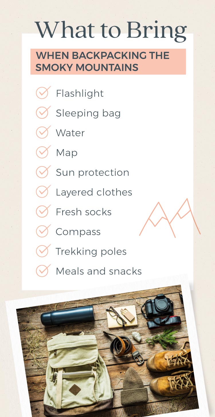
Backpacking in the Smokies can be an amazing adventure, but it’s important to prepare yourself for a safe and enjoyable experience in the backcountry.
In addition to following the National Park Service regulations, backpackers need to monitor changing weather conditions and prepare for wildlife encounters, particularly from black bears. Before you backpack in the Smokies for the first time, review what to bring, wear, and prepare.
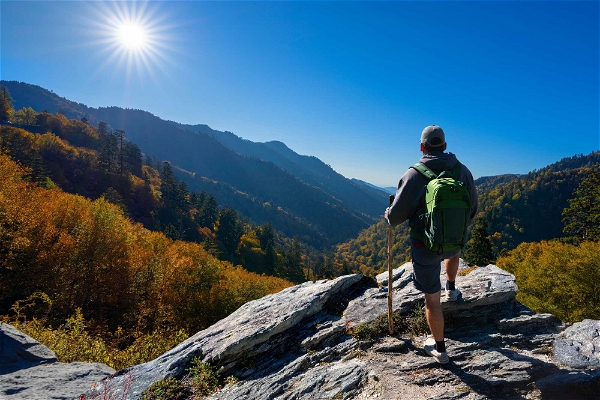
We often hear the best time of year in the Smoky Mountains is in the late spring, summer and early fall.
Spring is when everything comes alive, and visitors can enjoy warming weather before large summer crowds arrive. Summer temperatures are great for exploring all 800 miles of hiking trails in the park, and this is the best time for water activities like swimming and rafting.
This is also the most crowded season in the park, so plan ahead. Fall brings vibrant foliage and cooler temperatures, perfect for outdoor activities. While chilly weather and icy roads can deter visitors in winter, this is great for those seeking solitude and expansive mountain views after the leaves have fallen.
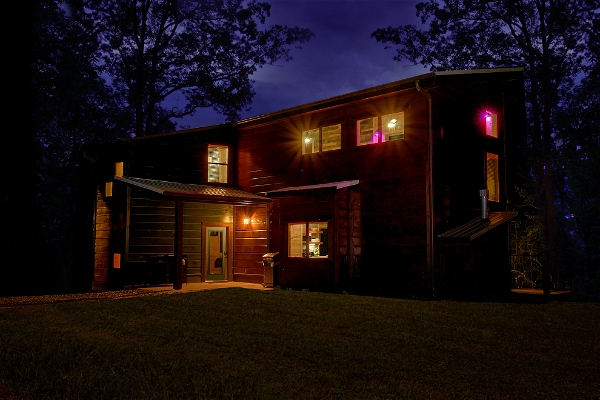
No matter where or when you go backpacking in the Smoky Mountains, you will surely have an incredible adventure and create lasting memories. After your backpacking adventure, unwind in a relaxing luxury cabin and continue experiencing the magic of the Smokies with the creature comforts you need after a trek.
Sorry, Cabins can’t be previewed in the block editor. You can instead save this post as a draft to preview before publishing.
 7 Easy Hikes in the Smoky Mountains for Anyone to Enjoy
 16 Things To Do in Wears Valley: Sightseeing, Shopping, Eating, and Adventuring
 Plan A Romantic Getaway to Gatlinburg, TN
 Babymoons Are All the Rage in Gatlinburg, TN
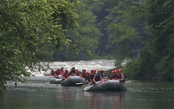 White Water Rafting in Gatlinburg & The Smokies